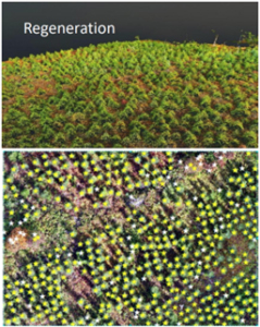
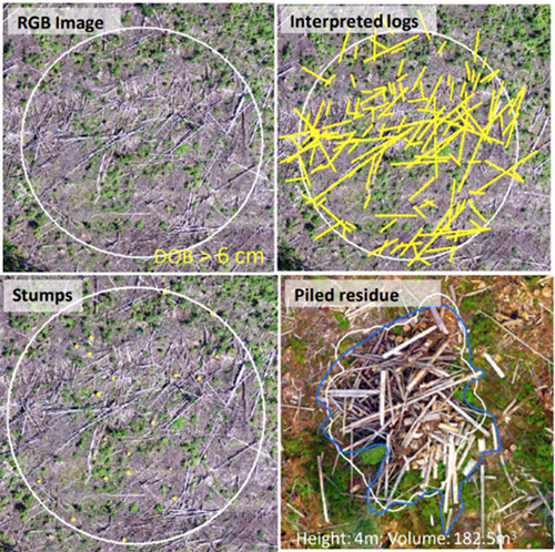
One of the challenges that the forest managers are facing is the lack of precision inventory tools at the operational level. Forest managers do not currently have the tools to efficiently and accurately measure dispersed residues and forest regeneration.

In an era of automation, digital transformation, and the need for live accurate data, FPInnovations has been working on using drones to create responsive remote sensing solutions that would address these issues.
FPInnovations has been working on converting the data bits from a drone into actionable information bytes for supporting forest operations.
FPInnovations recently held an exclusive webinar to its members on automated interactive tools for post-harvest inventory and compliance using drone imagery, specifically for tracking and reporting the status of regeneration (FPSilvi) and of dispersed logging residues (FPResidue) with no or limited field assessment required with the process. For in-depth details, watch the recording of the webinar.

Link to English recording of webinar (reserved for FPInnovations members)
Link to French recording of webinar (reserved for FPInnovations members)
Both FPResidue and FPSilvi platforms are available for term licenses to FPInnovations member companies that are interested in participating in a validation trial.
If you’re interested in knowing more on the project or would like to become a commercial partner with FPInnovations, please contact
Source: FPInnovations


